









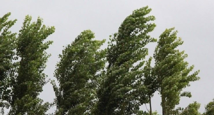
Southern California residents will begin experiencing rising temperatures and increasingly gusty Santa Ana winds Wednesday ahead of a potentially dangerous wind event Thursday and Friday that could bring damaging gusts, power outages and heightened wildfire danger across Los Angeles County.
The National Weather Service issued red flag warnings for much of Los Angeles County beginning at 6 a.m. Thursday and continuing until 10 p.m. Friday, warning that strong northeast winds, rapidly falling humidity and warming temperatures could create conditions favorable for large, fast-moving wildfires.
LA County Red flag warnings will cover the San Gabriel Mountains and San Gabriel valleys.
In Pasadena, no Red Flag warnings have been posted as of 4:30 a.m. Wednesday.
“HIGH CONFIDENCE in a MODERATE TO STRONG SANTA ANA event peaking this Thursday and Friday with damaging wind, power outages and large fast moving fires possible in the region,” the NWS said.
The strongest winds are expected in the San Gabriel Mountains and other wind-prone areas, where gusts could reach 60 to 70 mph. Areas covered by wind advisories could experience widespread gusts of 35 to 55 mph.
“Moderate to locally strong Santa Ana winds will quickly develop on Thursday, peak Thursday afternoon through Friday afternoon, then weaken through the weekend,” according to the NWS. “Meanwhile, dry air will settle over the region and dry out any helpful effects of the recent rains. … Some of the windiest areas may see Red Flag conditions linger into Saturday.”
Forecasters said mountain areas could experience northeast winds of 20 to 40 mph, with gusts reaching 70 mph in isolated locations. Humidity could fall to between 8% and 20%.
Other areas could see winds of 20 to 30 mph, gusting to 50 mph, with humidity dropping as low as 5%.
A high wind watch will be in effect from Thursday morning through Friday evening for the Western Santa Monica Mountains Recreational Area and San Gabriel Mountains.
“A Red Flag Warning means that critical fire weather conditions are either occurring now, or will shortly,” forecasters said. “Use extreme caution with anything that can spark a wildfire. Residents near wildland interfaces should be prepared to evacuate if a wildfire breaks out.”
Temperatures will also rise sharply as the Santa Ana winds develop, with coastal and valley communities expected to warm by roughly 10 degrees each day before peaking Friday with highs in the upper 80s to mid-90s in many areas.
The hot, dry and windy conditions could prompt Southern California Edison to implement public safety power shutoffs to reduce the risk of power lines sparking wildfires.
According to SCE’s website, more than 37,700 customers in Los Angeles County were being considered for possible power shutoffs as of Tuesday afternoon, although none had lost electricity under the program at that time.
Residents were urged to charge electronic devices, prepare emergency supplies, review evacuation routes and secure loose outdoor items.
The NWS also cautioned drivers about dangerous crosswinds, particularly on elevated roadways.
The weather service said Santa Ana winds could persist into Saturday, although conditions are expected to weaken over the weekend.
Temperatures will remain above normal through Sunday before a significant cooling trend begins early next week, according to forecasters.
 Get our daily Pasadena newspaper in your email box. Free.
Get all the latest Pasadena news, more than 10 fresh stories daily, 7 days a week at 7 a.m.