








Credit: Caltech
In computer simulations of The Big One—a large magnitude earthquake that may occur along the San Andreas Fault in California—seismic waves ripple from a magnitude 7.8 epicenter near the Salton Sea up into the Los Angeles Basin. For minutes in this simulation, the ground beneath downtown Los Angeles shakes like Jell-O because the region is built upon a deep basin of soft sediments, which can amplify seismic waves.
The structure and composition of the ground make a large impact on the strength of seismic shaking and whether it is felt as a quick jolt or a long reverberation. To understand and prepare for how a major earthquake will affect different areas of Southern California, a new Caltech study installed hundreds of temporary seismic stations throughout LA County to measure seismic activity and build a map of the shape of the basin below.
The map shows that soft sediments are up to 10 kilometers deep beneath downtown Los Angeles, whereas other regions such as the San Gabriel and San Bernardino valleys sit atop sediments that are much shallower. This kind of detailed information about the underground structure has direct impact on understanding building safety.
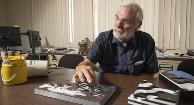
The study was led by Caltech graduate student Valeria Villa and conducted with seismologist Robert Clayton, professor of geophysics, emeritus. A paper describing the research appears in the journal JGR Solid Earth on August 4.
“When LA is hit by a large earthquake, there are going to be some city blocks that are damaged and some that are relatively unscathed,” Clayton says. “The underground basin variations control how the damage will be distributed.” Deeper sediments lead to longer-period shaking—long wavelengths of vibration analogous to a low musical note—which affects larger buildings more than shorter-period shaking, which is more like a high-pitched note.
To create the map of the basin, Clayton teamed with volunteers, including Villa and other Caltech graduate students and postdocs, to install 273 small seismic sensors throughout the LA region in 1–2 kilometer intervals. The sensors, which measure about 5 inches high sticking out of the ground, were spread from Pasadena to Long Beach and from Santa Monica to Orange County. In many cases, residential neighborhoods proved to be optimal locations for the sensors, and the teams engaged with local homeowners and renters to gain community participation. The sensors were deployed for a month.
Villa developed a detailed method for the sensors to incorporate measurements of gravity and seismic waves, allowing them to peer into the ground’s structure far below. These measurements were then transformed into a 3D map of the region.
“Such a study could not have been accomplished before,” she says. “The problem wasn’t a lack of seismic waves; it was that the basin itself scrambles the seismic signal. Our method, by incorporating gravity measurements, gave us another way to identify the buried interfaces despite that complexity.”
Next, the team aims to map how the sediments interface with bedrock below. Having a “strong bottom” beneath the basin causes seismic waves to bounce back upward, and knowing how the waves’ velocity behaves at these interfaces will give a more complete model of simulating strong ground motions. From there, the team hopes to better understand variations in the topmost kilometer of soil, where local variations are most consequential.
“From block to block, the soil can be very different, which impacts the shaking of buildings and houses,” Clayton says. “We need denser instrumentation—which may come from community-sourced qualitative methods such as ‘Did You Feel It’ reporting—to create an even more detailed picture.”
While many experts caution about the dangers of an earthquake along the San Andreas Fault to the east, Clayton notes that an earthquake originating within the LA basin could be similarly destructive, such as the 1933 Long Beach earthquake, which produced a magnitude 6.4 upon the Newport–Inglewood fault. The soft sedimentary ground beneath the region, combined with inadequate construction methods, led to significant damage.
The geographical data from the study is publicly available here.
The paper is titled “Three-Dimensional Structure of the Los Angeles Basin and Its Underlying Moho.” Funding was provided by the National Science Foundation (NSF). Villa is supported by an NSF Graduate Research Fellowship.
 Get our daily Pasadena newspaper in your email box. Free.
Get all the latest Pasadena news, more than 10 fresh stories daily, 7 days a week at 7 a.m.