









Motorists parking in certain Pasadena hillside neighborhoods face citations and towing under Red Flag parking restrictions that took effect at 7 a.m. Thursday, Oct. 15, as the city prepares for potentially dangerous wildfire conditions.
Pasadena Fire Chief Chad Augustin ordered the restrictions through 7 a.m. Saturday, Oct. 17, although they could be extended if weather conditions warrant.
The regulations, established in 2009, prohibit parking on designated narrow or winding streets to preserve access for fire engines and allow residents to evacuate during a wildfire.
Which streets are affected?
The restrictions primarily affect portions of streets around the Arroyo Seco in West Pasadena and foothill neighborhoods in East Pasadena.
The city’s official impacted-streets map identifies designated road segments in areas including the following:
West Pasadena and Arroyo Seco area: Poppy Peak Drive, Glen Oaks Boulevard, Avenue 64, La Loma Road, Patrician Way, Arroyo Boulevard, Forest Avenue and Lida Street.
East Pasadena foothills: Ranch Top Road, Startouch Drive, Valley Lights Drive, Edgeview Drive and streets around Hastings Ranch and Sierra Madre Villa Avenue.
These are geographic references to roads appearing in the city’s mapped areas, not a certification that parking is prohibited along their entire lengths. Some streets have restrictions on only one side or on particular blocks.
The city also identifies Red Flag gateway-warning sign locations at major approaches to affected neighborhoods, including:
- Altadena Drive near Veranda Avenue.
- New York Drive at Sierra Madre Villa Avenue.
- Hastings Ranch Drive south of Denair Street.
- Michillinda Avenue north of Valley View Avenue.
- Arroyo Boulevard south of San Rafael Avenue and south of Rosemont Avenue.
- Avenue 64 near Burleigh Drive and Glenover Drive.
- La Loma Road west of Sycamore Glen.
- Patrician Way near the western city boundary.
- San Rafael Road north of the 134 Freeway.
- Linda Vista Avenue near the Colorado bridge overpass, Fire Station 38 and the northern city boundary.
- California Boulevard west of Grand Avenue.
- Forest Avenue at Lincoln Avenue.
- Washington Boulevard west of Lincoln Avenue.
- Lida Street west of the Arts Center entrance.
Gateway signs do not necessarily indicate that parking is prohibited at those intersections. They alert motorists entering areas containing restricted streets.
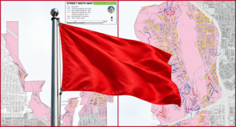
Residents can view the city’s official two-page Red Flag impacted-streets map at https://www.cityofpasadena.
The Pasadena Fire Department emphasizes that restrictions apply only where permanent Red Flag no-parking signs are posted. A street within a designated wildfire hazard zone is not automatically subject to the parking prohibition.
Why are the restrictions necessary?
Many streets near Pasadena’s hillsides and the Arroyo Seco are narrow or winding. Parked vehicles can obstruct fire engines entering neighborhoods or residents attempting to evacuate.
During periods of strong winds, low humidity and dry vegetation, wildfires can spread rapidly, increasing the need to keep emergency routes clear.
The restrictions are intended to improve emergency access, not prevent wildfires from starting.
What happens if motorists violate the restrictions?
Vehicles parked on designated restricted streets during an active Red Flag period can be cited and towed.
The prohibition remains in effect continuously, both day and night, until the announced expiration or cancellation.
Motorists whose vehicles are towed may also incur towing and storage expenses.
Are there any exemptions?
The municipal code provides limited exceptions for official city vehicles, certain licensed contractors performing work at an address for no more than 60 minutes and commercial delivery vehicles making deliveries for no more than 15 minutes. Conditions apply to each exemption.
Disabled-person parking placards and license plates do not exempt motorists from Red Flag restrictions.
Overnight parking permits also do not authorize parking on restricted blocks. However, residents may use those permits in nearby unrestricted spaces where parking is otherwise legal.
Where should residents move their vehicles?
Residents should use driveways, garages or lawful parking spaces on unrestricted streets.
Vehicles should remain off designated restricted streets until the city lifts the prohibition. The currently scheduled expiration is 7 a.m. Saturday, Oct. 17, but officials could extend the restrictions if dangerous fire-weather conditions persist.
How can residents check their streets or receive alerts?
Residents should first look for permanent Red Flag no-parking signs on their blocks and consult the city’s official map.
They can also register for emergency notifications through the Pasadena Local Emergency Alert System, known as PLEAS, at https://www.cityofpasadena.
For questions about a particular street or parking location, residents can contact Pasadena’s City Service Center at (626) 744-7311 or email redflagparking@cityofpasadena.
The city is also conducting additional fire patrols in foothill neighborhoods during the current alert.
Officials emphasize that keeping designated roadways clear during dangerous wildfire conditions can help emergency crews reach threatened homes and allow residents to evacuate safely.
 Get our daily Pasadena newspaper in your email box. Free.
Get all the latest Pasadena news, more than 10 fresh stories daily, 7 days a week at 7 a.m.