


Pasadena residents can expect a steady transition from warm, sunny weather to much cooler and potentially wetter conditions this week, with temperatures falling from around 80 degrees today to the mid-60s by the weekend, according to the National Weather Service.
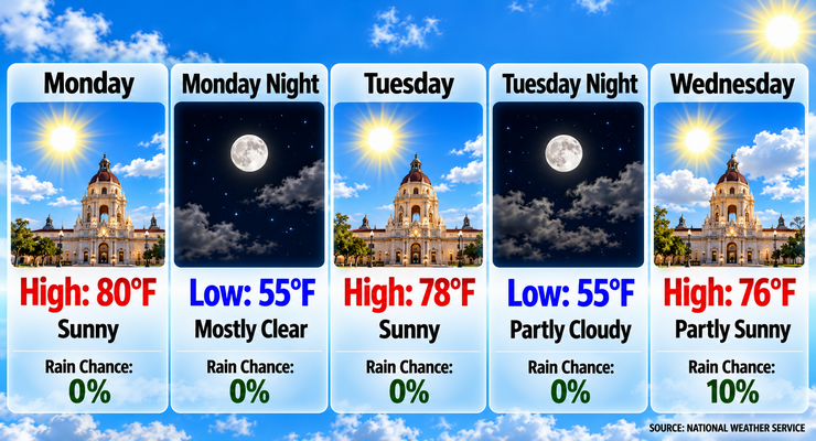
The warming trend that has dominated recent days will persist through the first half of the week. Forecasters expect sunny skies and a high near 80 degrees Monday, followed by mostly clear conditions overnight with temperatures dipping to about 55 degrees.
Tuesday will remain sunny with a high near 78 degrees. Overnight temperatures are expected to hold near 55 degrees under partly cloudy skies. Wednesday will bring increasing cloud cover, with partly sunny conditions and a high near 76 degrees. Wednesday night is expected to be mostly cloudy with a low around 56 degrees.
The cooling trend becomes more pronounced during the second half of the week. Temperatures are forecast to reach only 71 degrees Thursday under mostly cloudy skies before dropping to about 68 degrees Friday.
National Weather Service forecasters said increasing onshore flow, lowering atmospheric heights and expanding cloud cover will contribute to the gradual cooling trend across the region.
Rain chances enter the forecast Friday night, when a slight chance of showers is expected. The likelihood of precipitation increases during the weekend, with chances for showers Saturday, Saturday night and Sunday.
Forecasters said confidence is high that Southern California will receive rainfall during the weekend, although the timing and intensity of the storm remain uncertain. Current projections indicate many locations could receive around 1 inch of rain, with locally higher amounts possible in foothill areas.
In Pasadena, weekend temperatures are expected to remain cool, with highs near 65 degrees Saturday and Sunday. Skies will remain mostly cloudy Saturday before becoming partly sunny Sunday.
Winds throughout the week are expected to remain light. Afternoon southwest to south winds will generally range around 5 mph, with calmer conditions during the overnight and morning hours.
Looking ahead, forecasters said an active weather pattern could continue into next week, with additional opportunities for precipitation across Southern California.
Here is the Pasadena forecast from the National Weather Service as of 2:44 a.m. Monday:
Today: Sunny, with a high near 80. Calm wind becoming southwest around 5 mph in the afternoon.
Tonight: Mostly clear, with a low around 55. Southwest wind around 5 mph becoming calm in the evening.
Tuesday: Sunny, with a high near 78. Calm wind becoming south southwest around 5 mph in the afternoon.
Tuesday Night: Partly cloudy, with a low around 55. South southwest wind around 5 mph becoming southeast in the evening.
Wednesday: Partly sunny, with a high near 76. Calm wind becoming south around 5 mph in the afternoon.
Wednesday Night: Mostly cloudy, with a low around 56.
Thursday: Mostly cloudy, with a high near 71.
Thursday Night: Mostly cloudy, with a low around 56.
Friday: Partly sunny, with a high near 68.
Friday Night: A slight chance of showers. Mostly cloudy, with a low around 55.
Saturday: A chance of showers. Mostly cloudy, with a high near 65.
Saturday Night: A chance of showers. Mostly cloudy, with a low around 54.
Sunday: A chance of showers. Partly sunny, with a high near 65.
 Get our daily Pasadena newspaper in your email box. Free.
Get all the latest Pasadena news, more than 10 fresh stories daily, 7 days a week at 7 a.m.