


The National Weather Service in Los Angeles/Oxnard reported that Wednesday will be the warmest day of the week, with temperatures running 15 to 20 degrees above normal. Advisory-level Santa Ana winds are expected in foothill areas.
Thursday will bring partly sunny skies and highs near 83 degrees. Clouds will increase through the day as a trough approaches from the west. Winds will ease but remain breezy in some areas.
By Friday, highs will fall to the low 70s under mostly cloudy skies. Forecasters said temperatures will still remain slightly above seasonal averages despite the cooling trend.
The weekend is expected to be dry and pleasant. Saturday will be sunny with highs near 76 degrees, while Sunday will reach 79 degrees before patchy fog develops overnight.
Rain chances return early next week. The weather service said showers are possible Monday night through Wednesday night with totals ranging from a quarter of an inch to half an inch.
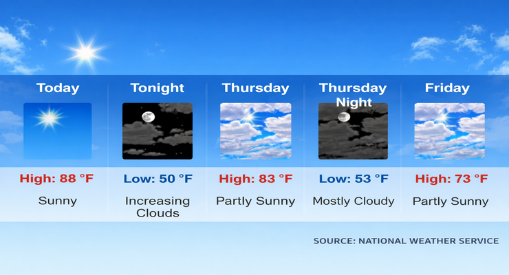
Here is the forecast for Pasadena from the National Weather Service as of 3:30 a.m. Wednesday:
Today: Sunny, with a high near 88. North northeast wind 5 to 10 mph becoming west in the afternoon.
Tonight: Increasing clouds, with a low around 50. Northeast wind around 5 mph.
Thursday: Partly sunny, with a high near 83. Northeast wind around 5 mph.
Thursday Night: Mostly cloudy, with a low around 53. Calm wind becoming east southeast around 5 mph.
Friday: Partly sunny, with a high near 73. Calm wind becoming south southwest around 5 mph.
Friday Night: Partly cloudy, with a low around 51.
Saturday: Sunny, with a high near 76.
Saturday Night: Mostly clear, with a low around 53.
Sunday: Sunny, with a high near 79.
Sunday Night: Patchy fog after 10:00 p.m. Otherwise, mostly cloudy, with a low around 53.
Monday: Patchy fog. Otherwise, partly sunny, with a high near 73.
Monday Night: A slight chance of rain. Mostly cloudy, with a low around 50.
Tuesday: A chance of rain. Partly sunny, with a high near 67.
 Get our daily Pasadena newspaper in your email box. Free.
Get all the latest Pasadena news, more than 10 fresh stories daily, 7 days a week at 7 a.m.