Although visitors to Pasadena will be looking forward to the Rose Parade as their main event, it’s worth knowing there are other things one can do while in the city this time of the year, including hiking around the Arroyo Seco area.
Several trails in the area are well suited to the recreational hiker who’s looking for a day hike, and some trails offer spectacular views of Pasadena and Altadena as well as distant views of Los Angeles.
Perhaps the most popular way to enjoy the Arroyo Seco is the Rose Bowl Loop where thousands of walkers amble around the 3.1 mile trail for exercise and relaxation. Recreational cyclists and racers also love this area, and several times a week, high-speed racers ride the loop, usually in the late afternoon.
The loop has an eight-foot-wide pedestrian lane painted on the asphalt that directs walkers to proceed in a counter-clockwise direction, but the signs are largely ignored, and most walkers still go clockwise.
For something a little bit more challenging, the Eaton Canyon Natural Area offers a scenic hike from the parking lot along N. Altadena Drive in Pasadena up to the Eaton Canyon Falls, a distance of about four miles.
Most hikers make it to the waterfall in about an hour and take a shorter time back. There are a few spots you’ll cross over water in by stepping on huge boulders and rocks. The 20-foot waterfall usually flows year-round, so it’s a great spot for photos and selfies.
Hikers should stop by the Eaton Canyon visitor’s center beforehand, for information about the trail, safety advice, and facts about local wildlife which can range from turtles to bears, and a few mountain lions and rattlesnakes as well.
Signs are abundant along the trail, and restrooms and water fountains are found near the visitor center. To get your parking space on N. Altadena Drive, you may have to arrive early, especially on weekend mornings.
The Gabrielino Trail, a U.S. National Recreation Trail that runs through the Angeles National Forest and passes through three major watersheds, starts near the Jet Propulsion Laboratory on Windsor Avenue. It offers about a mile and a half of paved trails leading to another three miles of dirt tracks that follow the Arroyo Seco, for a total of about eight miles out and back. It is well suited for the amateur hiker.
Some sections of the trail are closed, so check with the Angeles National Forest Office by calling (626) 574-1613, before going on this hike. The Gabrielino Trail is relatively flat and easy, but if you want a more strenuous workout, you’ll see signs for the Brown Mountain trails and an option to take the trail to the right which is mostly uphill, but it is not a severe incline. At the end of about six miles, you’ll be atop the Brown Mountain where the views are majestic.
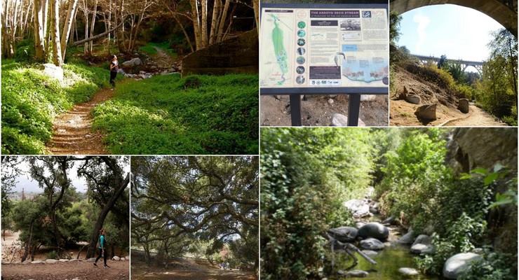
The Lower Arroyo Seco Recreation Area is another popular jaunt among Pasadena residents. Nature lovers and dog-walkers frequent the location, parking on the rim of the Arroyo Seco or in the parking lot of Pasadena’s Lower Arroyo Nature Park. They then walk down to the horse stables at South Pasadena city limits or up to the Colorado Street Bridge to cross the flood channel.
The northern part of this area contains the BFI low-flow stream experiment. Controlled flows are diverted below the Colorado Street Bridge and directed into streamzones on both sides of the flood channel. The riparian habitat has become so thick that it is often hard to see the stream. The flow in the artificial streams sometimes is turned off because of sediment buildup and maintenance problems. Still, the area is a welcome oasis from the urban hustle-and-bustle.
The trails offer an alternative to running or walking the Rose Bowl Loop, or you may want this as an extension for your run, as they link up to the Loop on both the north and south sides.
From Altadena, you can also hike about three miles one-way to the Henninger Campground, a sprawling trail camp in a scenic and special pine forest on Henninger Flats in the San Gabriel Mountains. The trail is up the Mount Wilson Toll Road, and the campground has a visitor information center and tree nursery operated by the Los Angeles County Fire Department. The campground has around 30 first-come-first-serve sites available year-round at no charge.
It takes less than an hour to get to the Flats. However, much of the trail is not shaded so bring plenty of water and a hat. Henninger Flats sits on a landing above steep mountain slopes and offers a shaded perch with panoramic views over the east end of the San Gabriel Valley.
In South Pasadena, there’s a little-known, but wonderful trail along the east side of the Arroyo Seco through Sycamore Park and the golf course area. It hugs the hillside and emerges into the four-acre nature park recently established by South Pasadena, just south of the golf course driving range near the York Street Bridge.
There is also a fun walkway along the Arroyo Seco Parkway (aka, Pasadena Freeway) over the Los Angeles River through Elysian Park into Solano Canyon near Dodger Stadium and Chinatown. It is accessible from a circular stairway around the freeway pilings at Avenue 19.
A great way to find information about hikes around Pasadena and the Arroyo Seco would be through Pasadena Hiking Pacers, a dedicated team of volunteers who have a passion for the outdoors and encourage like-minded nature lovers. You may connect with them through their website, www.pasadenahikingpacers.org, or by calling (626) 792-1221.


